


Dense fog and low clouds this morning will slowly erode by late morning. Enough sunshine will break through Monday to warm afternoon highs to near 80°, especially west of I-65 where less cloud cover will occur. This should be warm enough to trigger some pop-up showers and storms by mid-afternoon, but chances remain low through sunset today.
This lull in the rain ends late tonight with a surge of heavy rain and storms from out of the south, which is why a Flash Flood Watch goes into effect starting at 1:00 AM Tuesday. Expect several rounds of heavy rain daily Tuesday, Wednesday and into Thursday morning. This is due to a low pressure system stalling in central Mississippi, which will pump tropical moisture northward along and east of I-65.
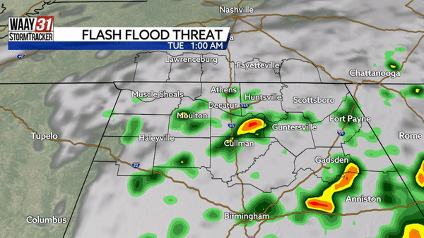
Rainfall totals of 2-4" of rain is expected for all of north Alabama. Areas closer to Sand Mountain could see local amounts of 4-6" which could trigger both flash flooding and flooding of creeks and rivers.

We finally begin to dry out through the day Thursday with mostly dry conditions by Friday and this weekend.